Mangrove Research Initiative
Understanding Change, Guiding Action in Coastal Ecosystems
Project Summary
Belize’s offshore mangrove cayes are vital coastal ecosystems, providing essential services such as shoreline protection, carbon storage, and support for fisheries. However, these habitats are increasingly threatened by climate change and direct human disturbances.
Mangroves are naturally dynamic systems that continuously adapt to changing environmental conditions. One factor that may accelerate their degradation is the presence of seabird rookeries. The nutrient enrichment from bird guano can lead to eutrophication, which weakens mangrove structure and stability over time.
These ecosystems are shaped by both ecological and social factors, making their dynamics complex but also offering opportunities for resilience and adaptation.
This project investigates the ecological condition of these cayes by:
-
Quantifying mangrove biomass and health,
-
Assessing aquatic and sediment biodiversity using environmental DNA (eDNA), and
-
Mapping the presence and activity of bird rookeries through GIS and field validation.
-
These combined approaches will help generate the knowledge needed to inform targeted conservation and long-term monitoring of Belize’s offshore mangrove ecosystems.

Mangrove root systems provide critical nursery habitat for commercially important fish and invertebrates. The complex structure offers shelter and feeding grounds for juvenile stages of species such as snapper, grunts, and lobster, contributing directly to the productivity of coastal fisheries in Belize.
Project Components
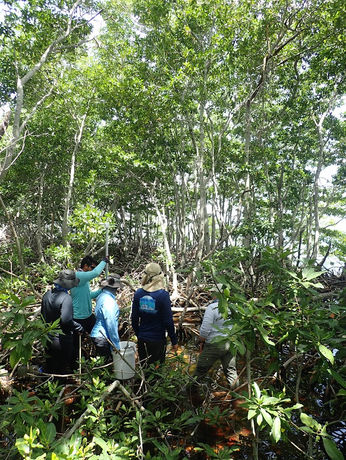
Component 1: Mangrove Biomass and Qualitative Assessment: To quantify and compare the aboveground biomass of mangroves on cayes with and without active bird rookeries. This will involve assessing the structural characteristics of the mangroves (e.g., height, diameter at breast height) and qualitatively evaluating their overall health and stability.
Component 2: eDNA Biodiversity Comparison: To compare the biodiversity of benthic and aquatic communities in the sediments and surrounding waters of mangrove cayes with and without bird rookeries using environmental DNA (eDNA) analysis. This will help determine if the nutrient enrichment from rookeries has cascading effects on the broader ecosystem.
Component 3: GIS Mapping and Rookery Validation: To accurately map the location and extent of offshore mangrove cayes and to validate the presence and activity status of bird rookeries on these cayes using Geographic Information Systems (GIS) and field observations. This spatial information is crucial for understanding the distribution of impacted areas and for future monitoring efforts.


-2.png)


